For leaders in public safety, maritime industries, and infrastructure, the value of aerial data is clear. But the cost of getting it (hiring pilots, managing rosters, and mitigating risk) is often too high.
Allswell solves this problem.
We provide a complete, automated system where the flight mechanics, route planning, and safety checks are handled entirely by our software. You don’t need to be a drone expert. You simply define the objective, and our system delivers the data.
01
Public Safety
Complete Coverage Where Others Can’t Reach
The biggest challenge in wildfire response is the sheer scale of the terrain. Traditional solutions like watchtowers are limited by line-of-sight, and satellites may not be overhead when you need them most. These gaps in coverage can leave communities vulnerable.
Allswell closes the gap. Our autonomous systems are designed to reach difficult, remote areas that static tools miss. Most importantly, our flight software is engineered for 99.99% reliability, allowing us to operate safely over people and property. We provide the comprehensive coverage you need to track fire behavior, ensuring no blind spots remain in your response strategy.
02
Maritime Operations
One-Click Efficiency
For commercial fishing fleets, efficiency is everything. Historically, finding fish meant deploying manned helicopters. This requires storing aviation fuel, maintaining extremely expensive hardware, and risking the lives of pilots flying low over the open ocean.
We offer a smarter, safer alternative. Our drones are 100% battery-operated, removing the need for hazardous fuel storage. With just one click, you can launch a persistent aerial search without a pilot onboard. We replace high-risk, high-cost helicopters with a safe, automated system that extends your visual range and protects your bottom line.
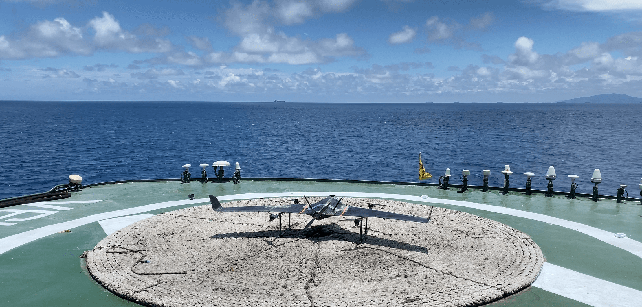
Our VTOL system launches directly from the vessel deck for wide-area search operations.
03
Infrastructure
Adaptive, Close-Range Precision
Grid reliability requires a closer look than a helicopter can provide. Inspecting high-voltage power lines is dangerous work. Manned helicopters must keep a safe distance, often missing the subtle details required to prevent outages.
Allswell allows for safe, close-range inspection that puts no humans at risk. Our advanced autonomy doesn’t just fly a pre-set GPS path; it actively traces the powerlines. Even if the lines have sagged due to heat or moved due to wind, our drones adapt in real-time to follow the infrastructure perfectly. We get the camera right where it needs to be, delivering the high-fidelity data you need to maintain the grid.
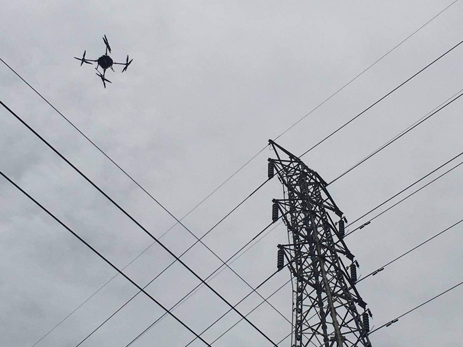
Autonomous inspection of high-voltage transmission infrastructure.
The Allswell Promise
Technology should make your job easier, not harder. We don’t just sell hardware; we partner with your operation. We have engineered the complexity out of the system so that Allswell feels like a dedicated member of your team.
We adapt to your environment, integrate with your workflow, and keep flying until you have the answers you need.
One fleet. One partner. Complete operational awareness.
Ready to see what persistent coverage looks like?
Tell us about your operation and we’ll show you how Allswell fits.